
Photogrammetric surveying uses photographs taken from an aircraft (or from the ground in some cases) to indirectly measure objects on the ground to produce point coordinates or maps.
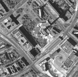
Airborne photograph
(Source: Leica Geosystems)
Photogrammetry can be a very cost-effective way to obtain accurate information for areas inaccessible to ground based survey crews.
No actual physical measurements are made of the specific ground features. However, we can, for example, produce a 3-dimensional model from photographs taken at an altitude of 600 meters above the ground. From this model, distances between objects or differences in heights can be measured to an accuracy of 3 cm to 10 cm. pretty impressive, wouldn’t you say?
Photogrammetric surveys can be horizontal, vertical or both. They can be used for:
- Densification of survey control,
- Cadastral surveys,
- Topographic Surveys,
- Terrain Analysis,
- Stockpile, gravel pit or land fill monitoring and volume surveys, and
- Route location and planning of utilities, pipelines and transmission lines.