
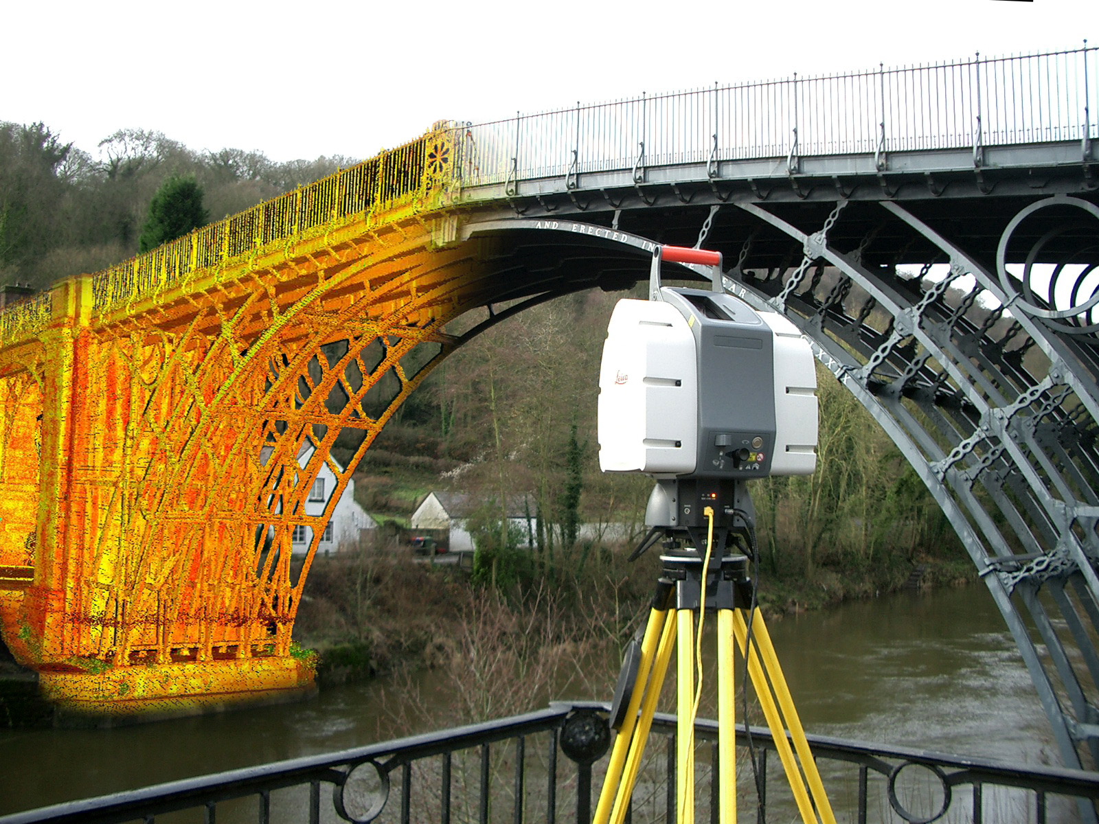
3D Laser Scanning Defined
Laser scanning is a relatively new technology, having been used as a precise survey instrument only since 1998. Now, it is quickly becoming the new industry standard as a way to make very accurate measurements in complicated environments. This is precisely why using this technology is the best solution for measuring as-built conditions inside buildings. This instrument collects survey data points at a rate of 50,000 points per second. It has an effective range of 400’ to 500’. With several “scan” setups inside a room or of a building, a complete 3D model can be made of the existing conditions. These models are then used to create 2D civil or architectural drawings, 3D computer models, and final survey documents.
Crime Scene and Accident Investigation
A crime or accident scene can be quickly, accurately and comprehensively captured in 3D to aid in the forensic analysis. This allows, for example, lines of site or bullet trajectories to be easily and accurately verified, or the scene of a fall or a collapsed building after an earthquake to be modeled.
The use of a laser scanner allows large volumes of data to be recorded remotely in a relatively short period of time and permits forensic analysts and investigators to digitally revisit the scene as necessary. And 3D data is also much more recognizable and understandable to laymen who may have an interest in the analysis (for example, judges and jury members).
Speed. Accuracy. Results.
NYCLS’s 3D surveying team has extensive experience in a broad range of measurement, data processing and data modeling techniques.
Utilizing our extensive tool set, ranging from tapes and distos to state-of-the-art laser scanning, we streamline the project workflow by applying and integrating the most effective tools and techniques for each project.
The result is a 3D data set from which we can devise a comprehensive set of deliverables, ranging from conventional 2D plans all the way up to highly accurate and detailed building information models.
How do we get from a point cloud to a 3D model?
The point cloud alone is not an intuitive product for the uninitiated user. The real skill comes in extracting the relevant information from a point cloud to create an accurate 3D model. At NYCLS we employ Cloudworx in AutoCAD to view the point cloud in small sections and use the data essentially as a template to create 2D line work and ultimately a full 3D model. Our 3D models can be as detailed or as simple as a client requests.
Processed data can be what you want it to be.
We capture data in 3D and ultimately data is better understood by all in 3D. A 3D model is much easier to interpret than a series of 2D elevations. Furthermore 3D CAD models can now be viewed, measured and marked-up by anyone using Autodesk’s Design Review Software.
We do, of course, still offer conventional measured building products such as 2D floor plans and 2D elevations depending on the project specifications.